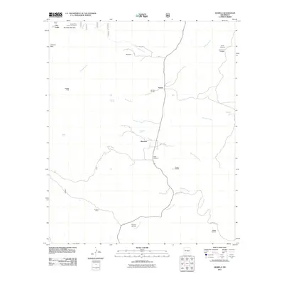
2011 Map of Arabela
USGS Topo · Published 2011About this map
Arabela stands as the central settlement in this eastern Lincoln County landscape, positioned along the northern reaches of the Agua Chiquita Creek drainage. The region is defined by a network of seasonal watercourses and springs, including Pino Real Spring and Matney Spring, which historically supported the isolated ranches and small communities like Ramerez and Bluewater. Evidence of early 21st-century mineral exploration is found at the Arabela Mines Incorporated Prospect near Boy Scout Mountain in the northwest. The presence of the Las Palas Cemetery near the main townsite provides a vital anchor for genealogical research, while landmarks such as Chimney Rock and Sunset Peak offer prominent navigational points across the canyons. The layout of county roads, such as County Rd-B040, illustrates the enduring rural transportation patterns connecting Whitaker Ranch to the surrounding hills.
Find a feature on this map
30 named features on this map. Tap any name to fly to it.
Don’t see what you’re looking for? This feature index may not catch every label — zoom into the map to look around manually.
Map Details
Editions of this 2011 Arabela Map
This is the sole edition of this map. No revisions or reprints were ever made.
Other maps of this area

1935 · Capitan Mountains
USGS Topo · 1:48,000

1936 · Arabela
USGS Topo · 1:48,000

1940 · Capitan Mountains
USGS Topo · 1:62,500

1942 · Arabela
USGS Topo · 1:62,500

1955 · Roswell
USGS Topo · 1:250,000

1958 · Roswell
USGS Topo · 1:250,000

1961 · Lincoln
USGS Topo · 1:62,500

1961 · Tinnie
USGS Topo · 1:62,500

1962 · Roswell
USGS Topo · 1:250,000
1981 · Kyle Harrison Canyon
USGS Topo · 1:24,000