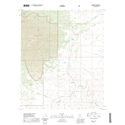
2023 Map of Arabela
USGS Topo · Published 2023About this map
Arabela sits at the junction of several canyon systems in Lincoln County, where the high terrain of the Capitan Mountains Wilderness meets the lower drainage basins. This area of the Lincoln National Forest is defined by its vital water sources, including Las Palas Spring and Bluewater Spring, which historically supported remote ranching and settlement. The small community at Arabela is anchored by Las Palas Cem, a significant site for local family history and genealogy.
Find a feature on this map
34 named features on this map. Tap any name to fly to it.
Don’t see what you’re looking for? This feature index may not catch every label — zoom into the map to look around manually.
Map Details
Editions of this 2023 Arabela Map
This is the sole edition of this map. No revisions or reprints were ever made.
Other maps of this area

1935 · Capitan Mountains
USGS Topo · 1:48,000

1936 · Arabela
USGS Topo · 1:48,000

1940 · Capitan Mountains
USGS Topo · 1:62,500

1942 · Arabela
USGS Topo · 1:62,500

1955 · Roswell
USGS Topo · 1:250,000

1958 · Roswell
USGS Topo · 1:250,000

1961 · Lincoln
USGS Topo · 1:62,500

1961 · Tinnie
USGS Topo · 1:62,500

1962 · Roswell
USGS Topo · 1:250,000
1981 · Kyle Harrison Canyon
USGS Topo · 1:24,000