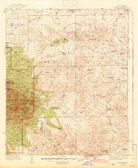
1942 Map of Arabela
USGS Topo · Published 1942About this map
The Capitan Mountains rise sharply in the western portion of this 1930s survey, anchoring a landscape where the Lincoln National Forest meets the high desert plains. High points like Sunset Peak and Pine Lodge Boy Scout Mtn look out over a complex system of drainages, including Copeland Canyon and Michaellas Canyon. This era of ranching is clearly defined by scattered homesteads and water sources, such as the Purcella Ranch, Roberts Ranch, and the isolated Millers Windmill.
Find a feature on this map
54 named features on this map. Tap any name to fly to it.
Don’t see what you’re looking for? This feature index may not catch every label — zoom into the map to look around manually.
Map Details
Editions of this 1942 Arabela Map
2 editions found
Other maps of this area

1935 · Capitan Mountains
USGS Topo · 1:48,000

1936 · Arabela
USGS Topo · 1:48,000

1940 · Capitan Mountains
USGS Topo · 1:62,500

1942 · Arabela
USGS Topo · 1:62,500

1955 · Roswell
USGS Topo · 1:250,000

1958 · Roswell
USGS Topo · 1:250,000

1961 · Lincoln
USGS Topo · 1:62,500

1961 · Tinnie
USGS Topo · 1:62,500

1962 · Roswell
USGS Topo · 1:250,000

1962 · Horseshoe Bend
USGS Topo · 1:62,500