
1942 Map of Arabela
USGS Topo · Published 1942About this map
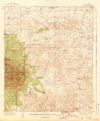
The Capitan Mountains dominate the western horizon of this high-desert landscape, where the settlement of Arabela sits at the junction of the Duran Road and Arabela Creek. Surveyed in the mid-1930s, the map reveals a ranching economy defined by isolated outposts and vital water sources. Family-named landmarks such as the Owens Ranch, Russell Bird Ranch, and Pacheco Ranch are scattered across a complex drainage system including Serrano Arroyo and Middle Arroyo.
Find a feature on this map
58 named features on this map. Tap any name to fly to it.
Don’t see what you’re looking for? This feature index may not catch every label — zoom into the map to look around manually.
Map Details
Editions of this 1942 Arabela Map
2 editions found
Other maps of this area

1935 · Capitan Mountains
USGS Topo · 1:48,000

1936 · Arabela
USGS Topo · 1:48,000

1940 · Capitan Mountains
USGS Topo · 1:62,500

1955 · Roswell
USGS Topo · 1:250,000

1958 · Roswell
USGS Topo · 1:250,000

1961 · Lincoln
USGS Topo · 1:62,500

1961 · Tinnie
USGS Topo · 1:62,500

1962 · Roswell
USGS Topo · 1:250,000

1962 · Horseshoe Bend
USGS Topo · 1:62,500

1967 · North Lake
USGS Topo · 1:24,000