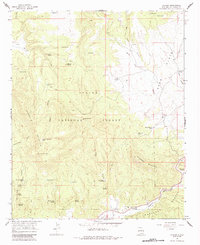
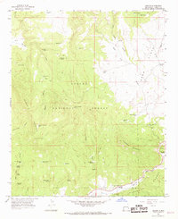
1965 Map of Aragon
USGS Topo · Published 1984About this map
The settlement of Aragon occupies a high valley where the Tularosa River flows between the southern boundary of the Apache National Forest and the northern reaches of the Gila National Forest. This 1960s landscape is defined by its critical water sources, from the Santonino Sch near the river to an extensive network of named springs and tanks like Malpais Spring and Negrilo Springs scattered throughout the rugged forest terrain. The map details the transition from the flat expanses of the Sand Flats to the elevations of Apache Mountain and Tularosa Mountain. A single Prospect and a Gaging Sta reflect the light human imprint on this high-country environment, while a web of Jeep Trails and Pack Trails provide the primary means of navigating the canyons and draws.
Find a feature on this map
48 named features on this map. Tap any name to fly to it.
Don’t see what you’re looking for? This feature index may not catch every label — zoom into the map to look around manually.
Map Details
Editions of this 1965 Aragon Map
2 editions found
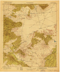
Other maps of this area

1915 · Reserve
USGS Topo · 1:125,000
1918 · Pelona
USGS Topo · 1:125,000
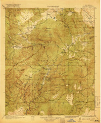
1918 · Reserve
USGS Topo · 1:125,000

1954 · Clifton
USGS Topo · 1:250,000

1954 · Saint Johns
USGS Topo · 1:250,000

1957 · Clifton
USGS Topo · 1:250,000

1957 · Saint Johns
USGS Topo · 1:250,000

1958 · Clifton
USGS Topo · 1:250,000

1958 · Saint Johns
USGS Topo · 1:250,000

1962 · Clifton
USGS Topo · 1:250,000