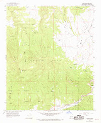
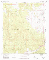
1965 Map of Aragon
USGS Topo · Published 1968About this map
Aragon sits at the southern edge of this mid-1960s survey, marking a small pocket of settlement where the Tularosa River cuts through the high timberlands of the Apache National Forest and Gila National Forest. This high-altitude landscape is defined by its water resources, with dozens of named springs and tanks like Negrito Springs, Willow Bush Spring, and Banta Spring supporting livestock and wildlife across the dissected plateaus. The topography is dominated by massive landforms such as Tularosa Mountain and Apache Mtn, while the Sand Flats provide a more level break in the northeast. Human infrastructure remains light, consisting primarily of a network of Pack Trails and Jeep Trails that navigate deep drainages like Negro Canyon and Schoolhouse Canyon. For local historians, the presence of the Santonino Sch and a Gaging Sta on the river near the settlement provides a glimpse into the community infrastructure and water management of the era.
Find a feature on this map
51 named features on this map. Tap any name to fly to it.
Don’t see what you’re looking for? This feature index may not catch every label — zoom into the map to look around manually.
Map Details
Editions of this 1965 Aragon Map
2 editions found
Other maps of this area

1915 · Reserve
USGS Topo · 1:125,000
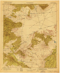
1918 · Pelona
USGS Topo · 1:125,000
1918 · Reserve
USGS Topo · 1:125,000

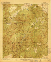
1954 · Clifton
USGS Topo · 1:250,000

1954 · Saint Johns
USGS Topo · 1:250,000

1957 · Clifton
USGS Topo · 1:250,000

1957 · Saint Johns
USGS Topo · 1:250,000

1958 · Clifton
USGS Topo · 1:250,000

1958 · Saint Johns
USGS Topo · 1:250,000

1962 · Clifton
USGS Topo · 1:250,000