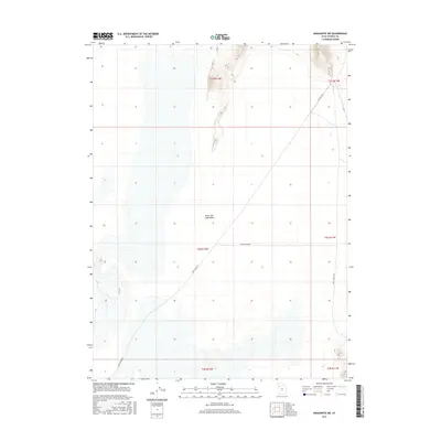
2017 Map of Aragonite SW
USGS Topo · Published 2017About this map
The Great Salt Lake Desert dominates this Tooele County landscape, where the vast alkali flats are segmented by a grid of Public Land Survey System township and range lines. The terrain is largely defined by its geological openness, with the occasional relief of desert roads cutting across the dry expanse. Remote routes like White Rocks Rd and White Rock Rd provide the only significant human markers through the central and southern portions of the map, while Skull Valley Rd skirts the eastern edge. To the northeast, the topography shifts slightly as the desert floor meets more elevated ground, crossed by E Sahara Rd. This 2017 survey provides an exacting look at the modern state of one of the most desolate and unique environments in the American West, capturing the sparse infrastructure that supports travel across the salt flats.
Find a feature on this map
11 named features on this map. Tap any name to fly to it.
Don’t see what you’re looking for? This feature index may not catch every label — zoom into the map to look around manually.
Map Details
Editions of this 2017 Aragonite SW Map
This is the sole edition of this map. No revisions or reprints were ever made.
Other maps of this area

1953 · Tooele
USGS Topo · 1:250,000

1954 · Wildcat Mtn
USGS Topo · 1:24,000

1954 · Wig Mtn NW
USGS Topo · 1:24,000

1955 · Wig Mtn NE
USGS Topo · 1:24,000

1955 · Tooele
USGS Topo · 1:250,000

1973 · Knolls
USGS Topo · 1:24,000

1973 · Aragonite NW
USGS Topo · 1:24,000

1973 · Knolls SE
USGS Topo · 1:24,000

1973 · Aragonite SE
USGS Topo · 1:24,000

1973 · Aragonite SW
USGS Topo · 1:24,000