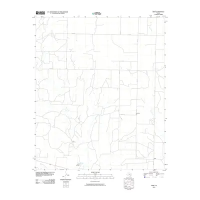
2010 Map of Arah
USGS Topo · Published 2010About this map
York Cemetery sits as a quiet landmark in this rural Scurry County landscape, positioned between the drainages of Gavett Creek and Red Mud Creek. The small community of Arah anchors the southeast, where FM 1269 serves as a primary artery through the rolling terrain. This 2010 survey illustrates a region defined by its hydrology and ranch roads, where intermittent watercourses like Mooar Creek and Deep Creek carve through the earth toward larger basins. To the south, Holmes Lake and the associated Holmes Lake Dam provide a rare permanent water feature in an otherwise arid environment. Notable elevations such as Hathaway Hill punctuate the horizon, offering a clear view of the sprawling network of county roads including Toombs Rd and Hughes Rd that connect the isolated homesteads and grazing lands of West Texas.
Find a feature on this map
20 named features on this map. Tap any name to fly to it.
Don’t see what you’re looking for? This feature index may not catch every label — zoom into the map to look around manually.
Map Details
Editions of this 2010 Arah Map
This is the sole edition of this map. No revisions or reprints were ever made.
Other maps of this area

1951 · Ira NW
USGS Topo · 1:24,000

1952 · Ira NE
USGS Topo · 1:24,000

1954 · Dermott
USGS Topo · 1:24,000

1954 · Big Spring
USGS Topo · 1:250,000

1958 · Big Spring
USGS Topo · 1:250,000

1969 · Gail NE
USGS Topo · 1:24,000

1969 · Arah
USGS Topo · 1:24,000

1969 · Fluvanna
USGS Topo · 1:24,000
1969 · Fivemile Creek
USGS Topo · 1:24,000

1969 · Flat Top Mountain
USGS Topo · 1:24,000