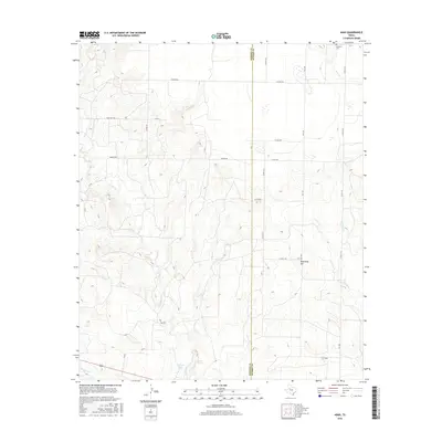
2016 Map of Arah
USGS Topo · Published 2016About this map
Arah and the surrounding ranchlands of West Texas are detailed in this 21st-century survey of the border between Borden Co and Scurry Co. The landscape is defined by the headwaters of several drainages, including Gavett Cr, Deep Cr, and Red Mud Cr, which carve through the terrain near landmarks like Hathaway Hill. This area is sparsely settled, with the small community of Arah located in the southeastern portion of the map, served by FM 1269.
Find a feature on this map
28 named features on this map. Tap any name to fly to it.
Don’t see what you’re looking for? This feature index may not catch every label — zoom into the map to look around manually.
Map Details
Editions of this 2016 Arah Map
This is the sole edition of this map. No revisions or reprints were ever made.
Other maps of this area

1951 · Ira NW
USGS Topo · 1:24,000

1952 · Ira NE
USGS Topo · 1:24,000

1954 · Dermott
USGS Topo · 1:24,000

1954 · Big Spring
USGS Topo · 1:250,000

1958 · Big Spring
USGS Topo · 1:250,000

1969 · Gail NE
USGS Topo · 1:24,000

1969 · Arah
USGS Topo · 1:24,000

1969 · Fluvanna
USGS Topo · 1:24,000
1969 · Fivemile Creek
USGS Topo · 1:24,000

1969 · Flat Top Mountain
USGS Topo · 1:24,000