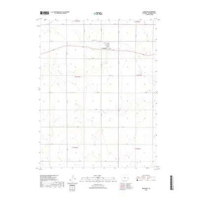
2019 Map of Arapahoe
USGS Topo · Published 2019About this map
Arapahoe serves as a localized hub in the eastern High Plains of Cheyenne County, where the township structure follows a rigid section-line grid typical of agricultural prairie development. This landscape is defined by the ephemeral drainages of the Smoky Hill River to the north and the meandering paths of N Fork Ladder Cr and Ladder Cr further south. These watercourses have historically dictated the placement of rural infrastructure in an otherwise arid environment.
Find a feature on this map
32 named features on this map. Tap any name to fly to it.
Don’t see what you’re looking for? This feature index may not catch every label — zoom into the map to look around manually.
Map Details
Editions of this 2019 Arapahoe Map
This is the sole edition of this map. No revisions or reprints were ever made.
Other maps of this area

1892 · Cheyenne Wells
USGS Topo · 1:125,000

1894 · Cheyenne Wells
USGS Topo · 1:125,000

1954 · Lamar
USGS Topo · 1:250,000

1958 · Lamar
USGS Topo · 1:250,000

1969 · Arapahoe SE
USGS Topo · 1:24,000

1969 · Cheyenne Wells 4 NE
USGS Topo · 1:24,000
1969 · Arapahoe NE
USGS Topo · 1:24,000

1981 · Cheyenne Wells
USGS Topo · 1:100,000
1982 · Arapahoe NW
USGS Topo · 1:24,000
1982 · Cheyenne Wells NE
USGS Topo · 1:24,000