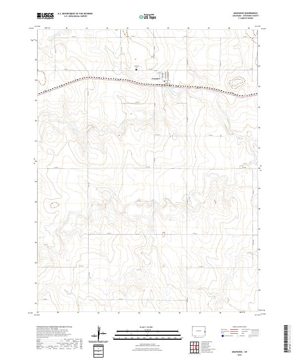
2022 Map of Arapahoe
USGS Topo · Published 2022About this map
The High Plains settlement of Arapahoe centers this survey, revealing the grid-based organization of eastern Colorado. Just north of the townsite, the Arapahoe Cem serves as a significant landmark for genealogical research. The landscape is defined by the ephemeral drainage patterns of the Smoky Hill River in the northwest and the winding paths of Ladder Cr and the N Fork Ladder Cr further south.
Find a feature on this map
32 named features on this map. Tap any name to fly to it.
Don’t see what you’re looking for? This feature index may not catch every label — zoom into the map to look around manually.
Map Details
Editions of this 2022 Arapahoe Map
This is the sole edition of this map. No revisions or reprints were ever made.
Other maps of this area

1892 · Cheyenne Wells
USGS Topo · 1:125,000

1894 · Cheyenne Wells
USGS Topo · 1:125,000

1954 · Lamar
USGS Topo · 1:250,000

1958 · Lamar
USGS Topo · 1:250,000

1969 · Arapahoe SE
USGS Topo · 1:24,000

1969 · Cheyenne Wells 4 NE
USGS Topo · 1:24,000
1969 · Arapahoe NE
USGS Topo · 1:24,000

1981 · Cheyenne Wells
USGS Topo · 1:100,000
1982 · Arapahoe NW
USGS Topo · 1:24,000
1982 · Cheyenne Wells NE
USGS Topo · 1:24,000