
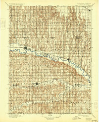
1898 Map of Arapahoe
USGS Topo · Published 1920About this map
The Republican River carves a central path through this late-nineteenth-century Nebraska landscape, serving as the primary corridor for settlement and transit. Along its banks, the Burlington and Missouri River R.R. connects a string of developing towns including Arapahoe, Edison, and Oxford. This rail-and-river network highlights the shift from early irrigation efforts, evidenced by the Irrigating Ditch near Arapahoe, to a more robust agricultural economy. To the south, Beaver City and Stamford sit along Beaver Creek, anchoring a grid of named townships like Eureka and Sappa. The topography is defined by the steep dissected draws of the Muddy Creek drainage to the north and the landmark Rock Falls near the Gosper-Phelps county line. These details provide a clear view of the state's southwestern borderlands just before the turn of the century.
Find a feature on this map
49 named features on this map. Tap any name to fly to it.
Don’t see what you’re looking for? This feature index may not catch every label — zoom into the map to look around manually.
Map Details
Editions of this 1898 Arapahoe Map
2 editions found
Other maps of this area

1893 · Norton
USGS Topo · 1:125,000

1893 · Phillipsburg
USGS Topo · 1:125,000

1896 · Lexington
USGS Topo · 1:125,000

1896 · Holdrege
USGS Topo · 1:125,000

1896 · Kearney
USGS Topo · 1:125,000

1896 · Arapahoe
USGS Topo · 1:125,000

1899 · Lexington
USGS Topo · 1:125,000

1902 · Gothenburg
USGS Topo · 1:125,000

1951 · Norton
USGS Topo · 1:62,500

1951 · Norcatur
USGS Topo · 1:62,500