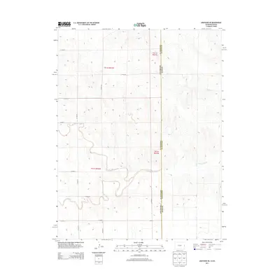
2013 Map of Arapahoe NE
USGS Topo · Published 2013About this map
The Smoky Hill River carves a winding path across this High Plains landscape, where the state line between Colorado and Kansas divides the terrain. The map captures the meeting point of Cheyenne and Wallace Counties, characterized by a sparse, grid-based road network designed for large-scale agricultural access. In the northern reaches, Willow Cr provides a secondary drainage system, while Big Timber Creek meanders through the central sections, creating natural relief against the formal township and range lines. The prevalence of named arterial routes like Co Road 58 and Co Road AA indicates the structured development of this rural borderland during the early twenty-first century.
Find a feature on this map
20 named features on this map. Tap any name to fly to it.
Don’t see what you’re looking for? This feature index may not catch every label — zoom into the map to look around manually.
Map Details
Editions of this 2013 Arapahoe NE Map
This is the sole edition of this map. No revisions or reprints were ever made.
Other maps of this area

1892 · Cheyenne Wells
USGS Topo · 1:125,000

1894 · Cheyenne Wells
USGS Topo · 1:125,000

1954 · Limon
USGS Topo · 1:250,000

1954 · Lamar
USGS Topo · 1:250,000

1954 · Goodland
USGS Topo · 1:250,000

1955 · Scott City
USGS Topo · 1:250,000

1956 · Goodland
USGS Topo · 1:250,000

1957 · Limon
USGS Topo · 1:250,000

1957 · Goodland
USGS Topo · 1:250,000

1958 · Limon
USGS Topo · 1:250,000