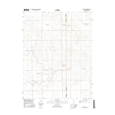
2016 Map of Arapahoe NE
USGS Topo · Published 2016About this map
The Smoky Hill River meanders across this High Plains landscape, marking a vital watercourse in a region defined by its wide, open drainage systems. This 2016 survey documents the precise intersection of the Colorado-Kansas border, where Cheyenne and Wallace Counties meet. The terrain is defined by a series of subtle draws and seasonal streambeds, including Big Timber Creek and Willow Cr, which carve through the shortgrass prairie. The human imprint is visible primarily through a strict grid of section lines and gravel tracks like Tumbleweed Rd and Nighthawk Rd. This map serves as a detailed record of the township and range system at work, showing how transportation routes like Co RD 57 and Outpost Rd have been adapted to the winding path of the river valley.
Find a feature on this map
23 named features on this map. Tap any name to fly to it.
Don’t see what you’re looking for? This feature index may not catch every label — zoom into the map to look around manually.
Map Details
Editions of this 2016 Arapahoe NE Map
This is the sole edition of this map. No revisions or reprints were ever made.
Other maps of this area

1892 · Cheyenne Wells
USGS Topo · 1:125,000

1894 · Cheyenne Wells
USGS Topo · 1:125,000

1954 · Limon
USGS Topo · 1:250,000

1954 · Lamar
USGS Topo · 1:250,000

1954 · Goodland
USGS Topo · 1:250,000

1955 · Scott City
USGS Topo · 1:250,000

1956 · Goodland
USGS Topo · 1:250,000

1957 · Limon
USGS Topo · 1:250,000

1957 · Goodland
USGS Topo · 1:250,000

1958 · Limon
USGS Topo · 1:250,000