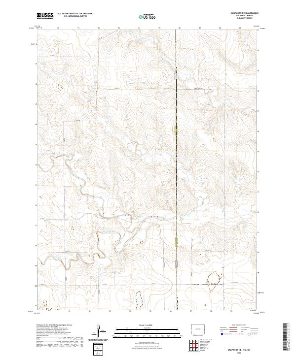
2022 Map of Arapahoe NE
USGS Topo · Published 2022About this map
The Smoky Hill River meanders across the southern half of this landscape, carving a distinct valley through the High Plains along the Colorado-Kansas border. This modern topographic study reveals a sparse, rural environment dominated by the Public Land Survey System's rigid grid, where section lines are traced by gravel routes such as Co Rd 57 and Co Rd 58. The drainage patterns of Big Timber Creek and Willow Cr emphasize the subtle elevation changes that define this transition between Cheyenne County, Colorado and Wallace County, Kansas. The naming of local routes like Tumbleweed Rd and Nighthawk Rd reflects a contemporary ranching or agricultural character, while the absence of dense town sites highlights the enduringly open nature of the borderlands.
Find a feature on this map
27 named features on this map. Tap any name to fly to it.
Don’t see what you’re looking for? This feature index may not catch every label — zoom into the map to look around manually.
Map Details
Editions of this 2022 Arapahoe NE Map
This is the sole edition of this map. No revisions or reprints were ever made.
Other maps of this area

1892 · Cheyenne Wells
USGS Topo · 1:125,000

1894 · Cheyenne Wells
USGS Topo · 1:125,000

1954 · Limon
USGS Topo · 1:250,000

1954 · Lamar
USGS Topo · 1:250,000

1954 · Goodland
USGS Topo · 1:250,000

1955 · Scott City
USGS Topo · 1:250,000

1956 · Goodland
USGS Topo · 1:250,000

1957 · Limon
USGS Topo · 1:250,000

1957 · Goodland
USGS Topo · 1:250,000

1958 · Limon
USGS Topo · 1:250,000