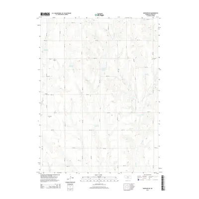
2014 Map of Arapahoe NE
USGS Topo · Published 2014About this map
Homerville Cem and Fairfield Cem anchor the north-central and eastern sections of this Gosper County landscape, representing the early rural community centers of this agricultural region. The terrain is defined by an intricate network of drainage systems, primarily focused on Turkey Cr and its tributaries, including W Br Turkey Cr and E Br Turkey Cr. In a region where water management is vital for the prairie landscape, numerous man-made features like Harmon Reservoir and Salisbury Reservoir are integrated into the rolling topography.
Find a feature on this map
37 named features on this map. Tap any name to fly to it.
Don’t see what you’re looking for? This feature index may not catch every label — zoom into the map to look around manually.
Map Details
Editions of this 2014 Arapahoe NE Map
This is the sole edition of this map. No revisions or reprints were ever made.
Other maps of this area

1896 · Lexington
USGS Topo · 1:125,000

1896 · Arapahoe
USGS Topo · 1:125,000

1898 · Arapahoe
USGS Topo · 1:125,000

1899 · Lexington
USGS Topo · 1:125,000

1955 · Grand Island
USGS Topo · 1:250,000

1957 · Grand Island
USGS Topo · 1:250,000

1958 · Grand Island
USGS Topo · 1:250,000

1958 · Edison
USGS Topo · 1:24,000
1958 · Arapahoe
USGS Topo · 1:24,000
1958 · Oxford
USGS Topo · 1:24,000