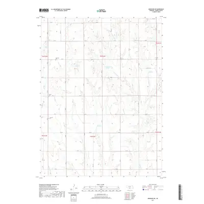
2017 Map of Arapahoe NE
USGS Topo · Published 2017About this map
Homerville Cem and Fairfield Cem serve as quiet landmarks across this agricultural section of Gosper County. The landscape is defined by a grid of rural routes including RD 735 and RD 428, which navigate the drainages of Turkey Cr and its tributaries, such as W Br Turkey Cr. This 2017 survey reveals an extensive network of small upland water management features, including Harmon Reservoir, Carlson Reservoir Number 2, and Salisbury Reservoir. These man-made ponds are critical to the local farming economy, capturing runoff in a region carved by seasonal flows like Big Antelope Cr and Dry Cr. For the local historian or genealogist, the inclusion of the McGuire Cem and Immanuel Cem provides specific points for tracing family roots within this rural township structure.
Find a feature on this map
44 named features on this map. Tap any name to fly to it.
Don’t see what you’re looking for? This feature index may not catch every label — zoom into the map to look around manually.
Map Details
Editions of this 2017 Arapahoe NE Map
This is the sole edition of this map. No revisions or reprints were ever made.
Other maps of this area

1896 · Lexington
USGS Topo · 1:125,000

1896 · Arapahoe
USGS Topo · 1:125,000

1898 · Arapahoe
USGS Topo · 1:125,000

1899 · Lexington
USGS Topo · 1:125,000

1955 · Grand Island
USGS Topo · 1:250,000

1957 · Grand Island
USGS Topo · 1:250,000

1958 · Grand Island
USGS Topo · 1:250,000

1958 · Edison
USGS Topo · 1:24,000
1958 · Arapahoe
USGS Topo · 1:24,000
1958 · Oxford
USGS Topo · 1:24,000