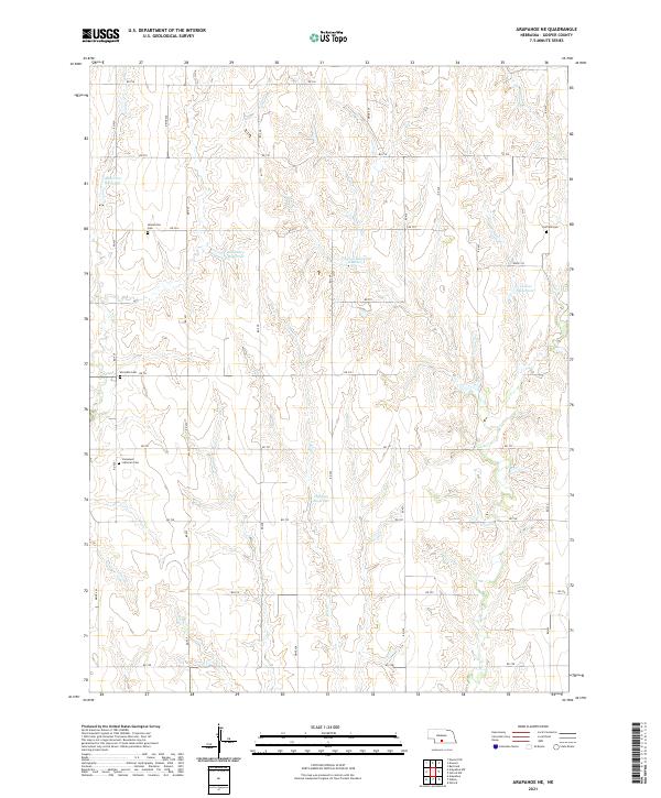
2021 Map of Arapahoe NE
USGS Topo · Published 2021About this map
Homerville Cem and Fairfield Cem sit at opposite ends of this Gosper County landscape, anchoring a rural district defined by the intricate drainage of Dry Cr. The terrain is characterized by a series of high-plateau farm fields intersected by a dense network of draws and small valleys, many of which have been modified to capture water. This modern water management system is evident in the numerous named impoundments such as Harmon Reservoir, Carlson Reservoir Number 2, and Salisbury Reservoir. A strictly organized grid of country roads, including RD 736 and RD 732, provides access to these isolated hilltops and cemeteries. The presence of the Immanuel Lutheran Cem and Mc Guire Cem further indicates the long-standing community ties in this agricultural pocket of Nebraska.
Find a feature on this map
27 named features on this map. Tap any name to fly to it.
Don’t see what you’re looking for? This feature index may not catch every label — zoom into the map to look around manually.
Map Details
Editions of this 2021 Arapahoe NE Map
This is the sole edition of this map. No revisions or reprints were ever made.
Other maps of this area

1896 · Lexington
USGS Topo · 1:125,000

1896 · Arapahoe
USGS Topo · 1:125,000

1898 · Arapahoe
USGS Topo · 1:125,000

1899 · Lexington
USGS Topo · 1:125,000

1955 · Grand Island
USGS Topo · 1:250,000

1957 · Grand Island
USGS Topo · 1:250,000

1958 · Grand Island
USGS Topo · 1:250,000

1958 · Edison
USGS Topo · 1:24,000
1958 · Arapahoe
USGS Topo · 1:24,000
1958 · Oxford
USGS Topo · 1:24,000