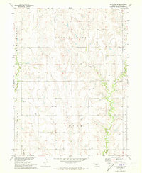
1971 Map of Arapahoe NE
USGS Topo · Published 1973About this map
Turkey Creek and its major tributaries, the West Branch and East Branch, carve a complex drainage pattern across this Gosper County landscape. The survey captures a rural environment defined by the Missouri River Basin development program, where the section-line roads of Union and Turkey Creek townships connect scattered homesteads and water wells. Significant for local genealogists, the map identifies several well-spaced burial grounds, including Homerville Cem, Fairfield Cem, McGuire Cem, and Immanuel Cem, reflecting the early settlement clusters of the Nebraska prairie. The topography transitions from the banks of East Muddy Creek and Elk Creek in the west to the higher plains, where School No 7 and a prominent Radio Tower serve as local landmarks in an area dominated by agriculture.
Find a feature on this map
17 named features on this map. Tap any name to fly to it.
Don’t see what you’re looking for? This feature index may not catch every label — zoom into the map to look around manually.
Map Details
Editions of this 1971 Arapahoe NE Map
This is the sole edition of this map. No revisions or reprints were ever made.
Other maps of this area

1896 · Lexington
USGS Topo · 1:125,000

1896 · Arapahoe
USGS Topo · 1:125,000

1898 · Arapahoe
USGS Topo · 1:125,000

1899 · Lexington
USGS Topo · 1:125,000

1955 · Grand Island
USGS Topo · 1:250,000

1957 · Grand Island
USGS Topo · 1:250,000

1958 · Grand Island
USGS Topo · 1:250,000

1958 · Edison
USGS Topo · 1:24,000
1958 · Arapahoe
USGS Topo · 1:24,000
1958 · Oxford
USGS Topo · 1:24,000