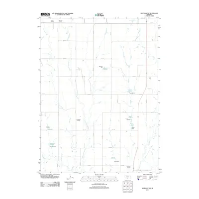
2011 Map of Arapahoe NW
USGS Topo · Published 2011About this map
Salem Lutheran Cemetery and Salem East Cemetery sit at the northern edge of this high plains landscape, indicating the settled rural heritage of Gosper County in the early 21st century. The map is defined by an intricate network of local drainages, including Elder Creek, Muddy Creek, and the East Branch Muddy Creek, which feed into numerous small-scale reservoirs. These water management features, such as Essmeger Reservoir, Menze Reservoir, and Monter Reservoir, characterize the agricultural reliance on the local watershed. The terrain transitions toward Union Ridge in the east, while a structured grid of rural routes like Road 736 and Road 421 connects the isolated farmsteads and cemeteries. This survey provides a precise record of the land ownership and water infrastructure patterns, with East Muddy Cemetery serving as a significant genealogical marker for families tied to the Muddy Creek valley.
Find a feature on this map
44 named features on this map. Tap any name to fly to it.
Don’t see what you’re looking for? This feature index may not catch every label — zoom into the map to look around manually.
Map Details
Editions of this 2011 Arapahoe NW Map
This is the sole edition of this map. No revisions or reprints were ever made.
Other maps of this area

1896 · Lexington
USGS Topo · 1:125,000

1896 · Arapahoe
USGS Topo · 1:125,000

1898 · Arapahoe
USGS Topo · 1:125,000

1899 · Lexington
USGS Topo · 1:125,000

1902 · Gothenburg
USGS Topo · 1:125,000

1954 · McCook
USGS Topo · 1:250,000

1955 · Grand Island
USGS Topo · 1:250,000

1957 · McCook
USGS Topo · 1:250,000

1957 · Grand Island
USGS Topo · 1:250,000

1958 · McCook
USGS Topo · 1:250,000