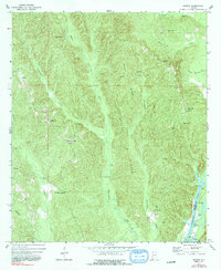
1971 Map of Ararat
USGS Topo · Published 1991About this map
The Old Indian Treaty Boundary slices diagonally across this rural landscape, marking a historical division that still shaped the land use and survey patterns in the early 1970s. This portion of Choctaw County is characterized by a dense network of ridges, including Wilson Ridge and Chatman Ridge, which dictate the placement of small upland settlements like Ararat and Pleasant Hill. The terrain drops sharply toward the eastern edge of the sheet, where the Tombigbee River forms the border with Clarke County.
Find a feature on this map
38 named features on this map. Tap any name to fly to it.
Don’t see what you’re looking for? This feature index may not catch every label — zoom into the map to look around manually.
Map Details
Editions of this 1971 Ararat Map
2 editions found
Other maps of this area

1953 · Hattiesburg
USGS Topo · 1:250,000

1953 · Meridian
USGS Topo · 1:250,000

1957 · Meridian
USGS Topo · 1:250,000

1958 · Hattiesburg
USGS Topo · 1:250,000

1965 · Meridian
USGS Topo · 1:250,000

1971 · Coffeeville
USGS Topo · 1:24,000

1971 · Ararat
USGS Topo · 1:24,000

1971 · Coffeeville Lock And Dam
USGS Topo · 1:24,000

1972 · Woods Bluff
USGS Topo · 1:24,000

1974 · Silas
USGS Topo · 1:24,000