
1956 Map of Arbuckle Hill
USGS Topo · Published 1959About this map
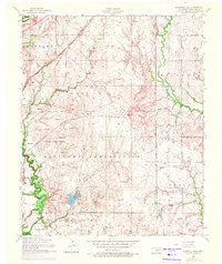
Fort Sill Military Reservation dominates this mid-century Oklahoma landscape, showing a complex network of training grounds and tactical landmarks. The terrain is defined by named rises such as Geronimo Hill, Comanche Hill, and Arbuckle Hill, providing a clear view of the area's geography before later development. In the southern portion of the reserve, the Fort Sill Indian School and a nearby Indian Cemetery mark significant cultural sites, while East Cache Creek and its tributary Wratton Creek flow through the training flats. The northeastern corner of the map reveals the emerging energy economy of the Zella area, dotted with an oil well and oil tanks. Transportation is anchored by the St Louis and San Francisco RR, which cuts diagonally across the northern panhandle near the settlement of Flagg.
Find a feature on this map
55 named features on this map. Tap any name to fly to it.
Don’t see what you’re looking for? This feature index may not catch every label — zoom into the map to look around manually.
Map Details
Editions of this 1956 Arbuckle Hill Map
4 editions found
Other maps of this area

1946 · Lawton
USGS Topo · 1:62,500

1949 · Arbuckle Hill
USGS Topo · 1:24,000

1949 · Cement
USGS Topo · 1:62,500

1949 · Elgin
USGS Topo · 1:24,000

1949 · Fort Sill
USGS Topo · 1:24,000

1949 · Nellie
USGS Topo · 1:62,500

1955 · Lawton
USGS Topo · 1:250,000

1956 · Sterling
USGS Topo · 1:24,000

1956 · Ninemile Creek
USGS Topo · 1:24,000

1956 · Fletcher
USGS Topo · 1:24,000
Featured Places
- Lawton, OK
- South East Corner Landing Strip, OK
- Beef Flats, Lawton
- Pig Farm Crossing, Lawton
- Dempsey Bridge, Lawton