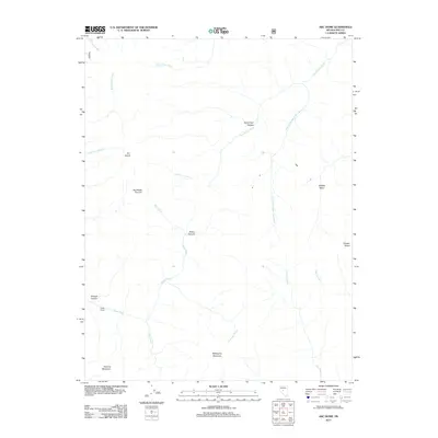
2011 Map of Arc Dome
USGS Topo · Published 2011About this map
Arc Dome and Toiyabe Dome dominate this high-altitude landscape in the heart of Nye County, where the headwaters of the Reese River emerge. The drainage patterns on this sheet are remarkably detailed, showing the divergent paths of the North Twin River and South Twin River alongside smaller tributaries like Stewart Creek and Broad Creek. The mapping reveals a terrain primarily used for range and livestock, evidenced by landmarks such as the Upper Corral and the South Twin Pasture. From the northern heights of the Southeast Summit down to Peavine Mountain in the south, this 2011 survey documents the stark hydrology and natural basins like Belcher Basin and Wrango Canyon that characterize this portion of the Toiyabe Range.
Find a feature on this map
21 named features on this map. Tap any name to fly to it.
Don’t see what you’re looking for? This feature index may not catch every label — zoom into the map to look around manually.
Map Details
Editions of this 2011 Arc Dome Map
This is the sole edition of this map. No revisions or reprints were ever made.
Other maps of this area

1907 · Tonopah
USGS Topo · 1:250,000

1908 · Tonopah
USGS Topo · 1:250,000

1956 · Tonopah
USGS Topo · 1:250,000

1959 · Tonopah
USGS Topo · 1:250,000

1962 · Tonopah
USGS Topo · 1:250,000

1971 · Carvers NW
USGS Topo · 1:24,000

1971 · Carvers
USGS Topo · 1:24,000

1971 · Pablo Canyon Ranch
USGS Topo · 1:24,000
1979 · Corral Wash
USGS Topo · 1:24,000
1979 · Toiyabe Peak
USGS Topo · 1:24,000