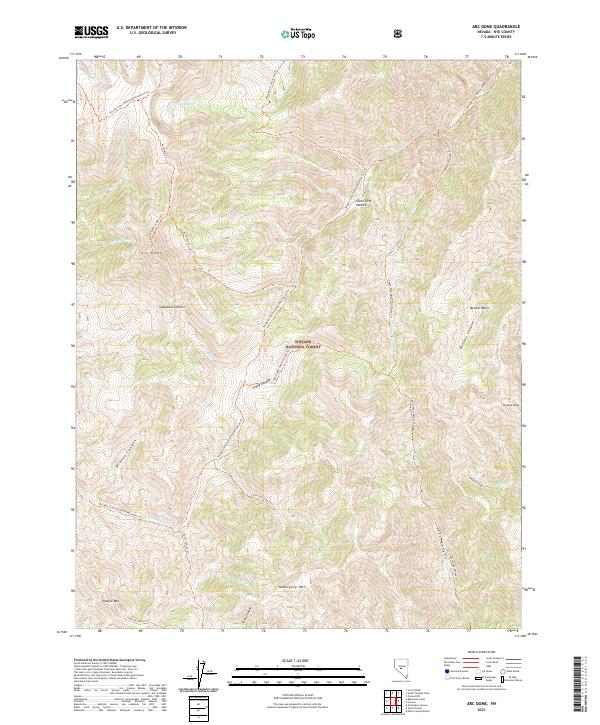
2021 Map of Arc Dome
USGS Topo · Published 2021About this map
Arc Dome serves as the central high point of this high-elevation landscape within the Toiyabe National Forest. The map documents a complex system of drainage and relief, where the Reese River and N Twin River headwaters carve through deep canyons like Wrango Canyon and Sheep Canyon. This 2021 survey reveals a primitive backcountry character, dominated by named peaks including Mahogany Mtn and Toiyabe Dome, rather than permanent settlements. Human presence is primarily indicated through an extensive network of footpaths, notably the Tolyabe Crest National Recreation Trl and the Arc Dome Trl. These trails connect remote geographic landmarks such as South Twin Pasture and Belcher Basin, illustrating how the region is managed for recreation and watershed protection. The surveyor's placement of several summits and canyons provides a detailed look at the crest of the Toiyabe Range during the early twenty-first century.
Find a feature on this map
40 named features on this map. Tap any name to fly to it.
Don’t see what you’re looking for? This feature index may not catch every label — zoom into the map to look around manually.
Map Details
Editions of this 2021 Arc Dome Map
This is the sole edition of this map. No revisions or reprints were ever made.
Other maps of this area

1907 · Tonopah
USGS Topo · 1:250,000

1908 · Tonopah
USGS Topo · 1:250,000

1956 · Tonopah
USGS Topo · 1:250,000

1959 · Tonopah
USGS Topo · 1:250,000

1962 · Tonopah
USGS Topo · 1:250,000

1971 · Carvers NW
USGS Topo · 1:24,000

1971 · Carvers
USGS Topo · 1:24,000

1971 · Pablo Canyon Ranch
USGS Topo · 1:24,000
1979 · Corral Wash
USGS Topo · 1:24,000
1979 · Toiyabe Peak
USGS Topo · 1:24,000