
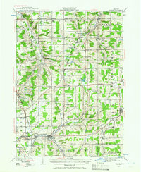
1923 Map of Arcade
USGS Topo · Published 1957About this map
Cattaraugus Creek winds along the southern edge of this 1923 survey, defining a landscape of high plateau dairy country and early 20th-century rail corridors. The Arcade and Attica and Pennsylvania railroads intersect at the bustling village of Arcade, while the Rochester and Pittsburgh cuts through the eastern hills near Bliss. This era shows a dense network of local schoolhouses, such as School No 12 and Cattaraugus Road School, which served the many crossroad hamlets like Strykersville, Java Center, and Johnsonburg. Named roads like Telegraph Road and Peter Bolt Road connect family-named junctions, including Punkshera Corners and Finks Corners. The terrain is marked by steep gullies and natural features like Java Lake and Angel Falls, illustrating the transition from agricultural valley floors to the high ridges of Crow Hill.
Find a feature on this map
83 named features on this map. Tap any name to fly to it.
Don’t see what you’re looking for? This feature index may not catch every label — zoom into the map to look around manually.
Map Details
Editions of this 1923 Arcade Map
2 editions found
Other maps of this area

1904 · Batavia
USGS Topo · 1:62,500

1905 · Attica
USGS Topo · 1:62,500

1905 · Portage
USGS Topo · 1:62,500

1905 · Depew
USGS Topo · 1:62,500

1906 · Angelica
USGS Topo · 1:62,500

1924 · Ellicottville
USGS Topo · 1:62,500

1924 · Franklinville
USGS Topo · 1:62,500

1925 · Springville
USGS Topo · 1:62,500

1925 · Arcade
USGS Topo · 1:62,500

1941 · Angelica
USGS Topo · 1:62,500