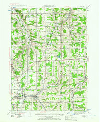
1923 Map of Arcade
USGS Topo · Published 1966About this map
Tonawanda Creek and the Cattaraugus Creek headwaters define the drainage of this western New York agricultural landscape in the 1920s. This survey records a highly organized network of small dairy and farming hamlets, often located at crossroads like Java Center, Sheldon Corners, and Five Corners. The era's transportation is dominated by the Pennsylvania and Buffalo and Attica railroads, which facilitated the movement of goods from stops such as North Java Sta.
Find a feature on this map
93 named features on this map. Tap any name to fly to it.
Don’t see what you’re looking for? This feature index may not catch every label — zoom into the map to look around manually.
Map Details
Editions of this 1923 Arcade Map
2 editions found
Other maps of this area

1904 · Batavia
USGS Topo · 1:62,500

1905 · Attica
USGS Topo · 1:62,500

1905 · Portage
USGS Topo · 1:62,500

1905 · Depew
USGS Topo · 1:62,500

1906 · Angelica
USGS Topo · 1:62,500

1923 · Arcade
USGS Topo · 1:62,500

1924 · Ellicottville
USGS Topo · 1:62,500

1924 · Franklinville
USGS Topo · 1:62,500

1925 · Springville
USGS Topo · 1:62,500

1925 · Arcade
USGS Topo · 1:62,500