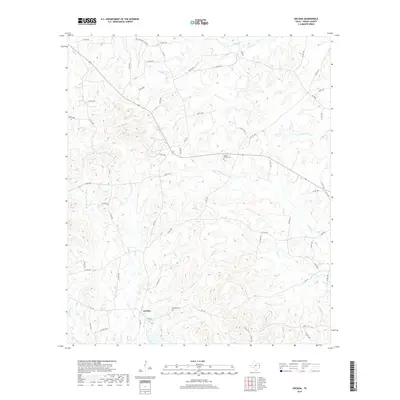
2019 Map of Arcadia
USGS Topo · Published 2019About this map
The settlement of Arcadia anchors the southern portion of this Shelby County landscape, situated at the intersection of local routes near Powdrill Cr and Pounds Cr. The terrain is defined by a dense network of winding waterways and bayous, including Bear Bayou and Chicken Bayou, which drain the low-lying timberlands. For those tracing family histories in East Texas, several landmarks are clearly noted, such as Powdrill Cem south of the main settlement and Mount Gillion Cem located near the banks of Huana Cr. The map reveals a complex web of rural roads, such as FM 1645 and Co RD 1490, that connect scattered homesteads through the creek valleys of Wheeler Cr and Penson Cr. This 2019 survey provides a precise look at the modern rural infrastructure imposed upon the natural drainage patterns of the East Texas Piney Woods.
Find a feature on this map
63 named features on this map. Tap any name to fly to it.
Don’t see what you’re looking for? This feature index may not catch every label — zoom into the map to look around manually.
Map Details
Editions of this 2019 Arcadia Map
This is the sole edition of this map. No revisions or reprints were ever made.
Other maps of this area

1953 · Palestine
USGS Topo · 1:250,000

1957 · Palestine
USGS Topo · 1:250,000

1958 · Center
USGS Topo · 1:62,500

1958 · San Augustine
USGS Topo · 1:62,500

1958 · Martinsville
USGS Topo · 1:62,500

1958 · Timpson
USGS Topo · 1:62,500

1984 · Palestine
USGS Topo · 1:250,000
1984 · Center
USGS Topo · 1:24,000
1984 · Tenaha East
USGS Topo · 1:24,000
1984 · Garrison East
USGS Topo · 1:24,000