
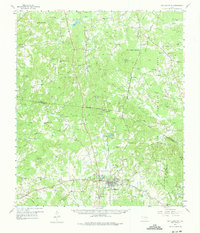
1958 Map of San Augustine
USGS Topo · Published 1959About this map
San Augustine serves as the focal point of this East Texas survey, where the historic path of El Camino Real intersects with the Gulf Colorado and Santa Fe Railroad. The landscape is a mix of dense woodland within the Sabine National Forest and scattered agricultural settlements like Denning, Neuville, and Choice. The map documents a deeply established rural social fabric, evidenced by the high density of country churches and family burial grounds such as Todd Springs Ch, Chumley Cem, and Providence Cem.
Find a feature on this map
115 named features on this map. Tap any name to fly to it.
Don’t see what you’re looking for? This feature index may not catch every label — zoom into the map to look around manually.
Map Details
Editions of this 1958 San Augustine Map
2 editions found
Other maps of this area

1944 · Logansport
USGS Topo · 1:62,500

1944 · Patroon
USGS Topo · 1:62,500

1953 · Alexandria
USGS Topo · 1:250,000

1953 · Palestine
USGS Topo · 1:250,000

1955 · Alexandria
USGS Topo · 1:250,000

1956 · Logansport
USGS Topo · 1:62,500

1956 · Patroon
USGS Topo · 1:62,500

1957 · Palestine
USGS Topo · 1:250,000

1958 · Center
USGS Topo · 1:62,500

1958 · Hemphill
USGS Topo · 1:62,500