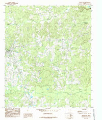
1984 Map of Tenaha East
USGS Topo · Published 1985About this map
Tenaha serves as the primary hub in this East Texas landscape, where the Southern Pacific railroad corridor and major routes like highway 59 intersect. The area is characterized by a dense network of creek systems including Flat Fork Creek, Spinney Creek, and Cypress Creek, which drain toward the Sabine River and the northern reaches of the Toledo Bend Res. Smaller settlements like Paxton and Mc Faddin anchor the rural landscape, punctuated by local landmarks such as the Tenaha Sch and the Lookout Tower located north of the main township.
Find a feature on this map
31 named features on this map. Tap any name to fly to it.
Don’t see what you’re looking for? This feature index may not catch every label — zoom into the map to look around manually.
Map Details
Editions of this 1984 Tenaha East Map
This is the sole edition of this map. No revisions or reprints were ever made.
Other maps of this area

1945 · Socagee Bayou
USGS Topo · 1:62,500

1953 · Palestine
USGS Topo · 1:250,000

1956 · Tyler
USGS Topo · 1:250,000

1956 · Deadwood
USGS Topo · 1:62,500

1957 · Palestine
USGS Topo · 1:250,000

1958 · Center
USGS Topo · 1:62,500

1958 · Timpson
USGS Topo · 1:62,500

1958 · Carthage
USGS Topo · 1:62,500
1983 · Logan
USGS Topo · 1:24,000
1983 · Old Center
USGS Topo · 1:24,000