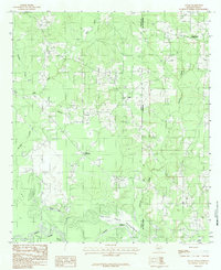
1983 Map of Logan
USGS Topo · Published 1983About this map
Logan and Galloway sit at the center of this rural landscape along the Texas-Louisiana border in the early 1980s. The geography is defined by the expansive Toledo Bend Reservoir and the Sabine River, which form the southern boundary of the study area. This period of the landscape shows the matured water levels of the reservoir, contrasted with the winding natural courses of Socagee Creek and Garrison Creek that drain the timbered uplands. Local family history is preserved in several rural Cem locations and small settlements like Belle Bower in the northeast. The road network connects these isolated communities through the creek-dissected terrain, while features like Booker Branch and Clear Lake provide specific landmarks for those tracing land tracts or genealogy in Panola County and De Soto Parish.
Find a feature on this map
14 named features on this map. Tap any name to fly to it.
Don’t see what you’re looking for? This feature index may not catch every label — zoom into the map to look around manually.
Map Details
Editions of this 1983 Logan Map
2 editions found
Other maps of this area

1944 · Logansport
USGS Topo · 1:62,500

1945 · Grand Cane
USGS Topo · 1:62,500

1945 · Socagee Bayou
USGS Topo · 1:62,500

1953 · Alexandria
USGS Topo · 1:250,000

1953 · Palestine
USGS Topo · 1:250,000

1955 · Shreveport
USGS Topo · 1:250,000

1955 · Alexandria
USGS Topo · 1:250,000

1956 · Shreveport
USGS Topo · 1:250,000

1956 · Tyler
USGS Topo · 1:250,000

1956 · Logansport
USGS Topo · 1:62,500