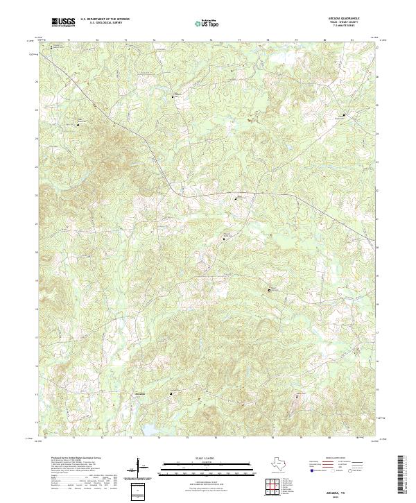
2022 Map of Arcadia
USGS Topo · Published 2022About this map
The settlement of Arcadia serves as a central hub in this corner of Shelby County, where the landscape is defined by the winding tributaries of Penson Cr and Wheeler Cr. The region's history is deeply rooted in its rural communities, as evidenced by the high density of family and community burial grounds scattered throughout the creek bottoms and uplands. These sites, including Powdrill Cem and Mount Zion Cem, often mark the locations of early homesteads and church congregations that shaped the area's development.
Find a feature on this map
69 named features on this map. Tap any name to fly to it.
Don’t see what you’re looking for? This feature index may not catch every label — zoom into the map to look around manually.
Map Details
Editions of this 2022 Arcadia Map
This is the sole edition of this map. No revisions or reprints were ever made.
Other maps of this area

1953 · Palestine
USGS Topo · 1:250,000

1957 · Palestine
USGS Topo · 1:250,000

1958 · Center
USGS Topo · 1:62,500

1958 · San Augustine
USGS Topo · 1:62,500

1958 · Martinsville
USGS Topo · 1:62,500

1958 · Timpson
USGS Topo · 1:62,500

1984 · Palestine
USGS Topo · 1:250,000
1984 · Center
USGS Topo · 1:24,000
1984 · Tenaha East
USGS Topo · 1:24,000
1984 · Garrison East
USGS Topo · 1:24,000