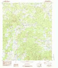
1984 Map of Arcadia
USGS Topo · Published 1985About this map
Arcadia and the surrounding piney woods of Shelby County are defined by an intricate network of waterways draining toward the east. This 1980s landscape shows the quiet rural character of eastern Texas, where small settlements like Huber and Folsom serve as local anchors. The terrain is notably dissected by numerous named drainages, including Huana Creek, Chicken Bayou, and Ramsey Creek, which influence the local road patterns and land use. Genealogists and local historians will find several rural Cem sites marked across the sheet, often located on higher ground near these creek systems. A prominent Lookout Tower stands as a landmark for forest management in this timber-heavy region. The map captures a moment before significant modern expansion, preserving the locations of family-named features like Pounds Creek and Walker Creek alongside the winding course of Beur Bayou.
Find a feature on this map
19 named features on this map. Tap any name to fly to it.
Don’t see what you’re looking for? This feature index may not catch every label — zoom into the map to look around manually.
Map Details
Editions of this 1984 Arcadia Map
This is the sole edition of this map. No revisions or reprints were ever made.
Other maps of this area

1953 · Palestine
USGS Topo · 1:250,000

1957 · Palestine
USGS Topo · 1:250,000

1958 · Center
USGS Topo · 1:62,500

1958 · San Augustine
USGS Topo · 1:62,500

1958 · Martinsville
USGS Topo · 1:62,500

1958 · Timpson
USGS Topo · 1:62,500

1984 · Palestine
USGS Topo · 1:250,000
1984 · Center
USGS Topo · 1:24,000
1984 · Tenaha East
USGS Topo · 1:24,000
1984 · Garrison East
USGS Topo · 1:24,000