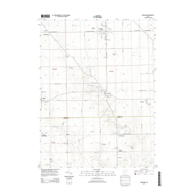
2013 Map of Arcanum
USGS Topo · Published 2013About this map
Arcanum serves as the primary hub in this agricultural landscape of Darke and Preble counties, where the grid of rural roads connects several small, long-standing settlements. The map highlights a series of hamlets along historical transit corridors, including Ithaca, Castine, Gordon, and West Manchester. The distribution of burial grounds like Beech Grove Cem and the Ithaca Lutheran Cem provides a clear view of early community centers and parish boundaries.
Find a feature on this map
78 named features on this map. Tap any name to fly to it.
Don’t see what you’re looking for? This feature index may not catch every label — zoom into the map to look around manually.
Map Details
Editions of this 2013 Arcanum Map
This is the sole edition of this map. No revisions or reprints were ever made.
Other maps of this area

1905 · Brookville
USGS Topo · 1:62,500

1911 · Covington
USGS Topo · 1:62,500

1944 · Covington
USGS Topo · 1:62,500

1953 · Cincinnati
USGS Topo · 1:250,000

1953 · Muncie
USGS Topo · 1:250,000

1956 · Muncie
USGS Topo · 1:250,000

1957 · Cincinnati
USGS Topo · 1:250,000

1960 · New Madison
USGS Topo · 1:24,000
1960 · Eaton North
USGS Topo · 1:24,000

1961 · Laura
USGS Topo · 1:24,000