
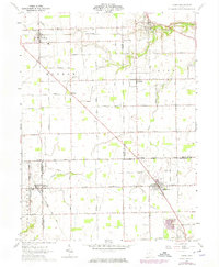
1961 Map of Laura
USGS Topo · Published 1962About this map
Agricultural patterns and small crossroads settlements define this landscape along the border of Darke, Miami, and Montgomery counties. Central to the area is the village of Laura, where the New York Central railroad tracks cross Ludlow Creek. Further south, the town of Phillipsburg sits near the headwaters of Wolf Creek, connected to the surrounding townships by a grid of family-named routes like Sweet Potato Ridge Road and Brumbaugh Rd.
Find a feature on this map
61 named features on this map. Tap any name to fly to it.
Don’t see what you’re looking for? This feature index may not catch every label — zoom into the map to look around manually.
Map Details
Editions of this 1961 Laura Map
2 editions found
Other maps of this area

1905 · Brookville
USGS Topo · 1:62,500

1911 · Covington
USGS Topo · 1:62,500

1944 · Covington
USGS Topo · 1:62,500

1953 · Cincinnati
USGS Topo · 1:250,000

1953 · Muncie
USGS Topo · 1:250,000

1955 · West Milton
USGS Topo · 1:24,000
1955 · Trotwood
USGS Topo · 1:24,000

1956 · Muncie
USGS Topo · 1:250,000

1957 · Cincinnati
USGS Topo · 1:250,000

1961 · Lewisburg
USGS Topo · 1:24,000