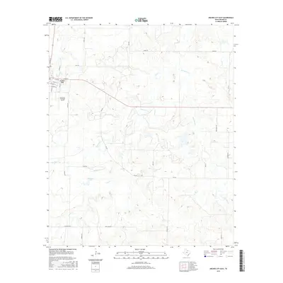
2016 Map of Archer City East
USGS Topo · Published 2016About this map
Archer City serves as the focal point of this North Texas survey, situated where a network of rural roads and farm-to-market routes branch into the surrounding ranchland. The eastern outskirts of the city are defined by the Archer City Municipal Airport and a grid of residential streets including E Main St and E Chestnut St. Moving away from the town center, the landscape is dictated by a system of ephemeral waterways, notably Onion Cr, Little Onion Cr, and Dogwood Cr, which carve through the terrain and occasionally feed into small bodies of water like Schrieber Lake.
Find a feature on this map
30 named features on this map. Tap any name to fly to it.
Don’t see what you’re looking for? This feature index may not catch every label — zoom into the map to look around manually.
Map Details
Editions of this 2016 Archer City East Map
This is the sole edition of this map. No revisions or reprints were ever made.
Other maps of this area

1931 · Archer City
USGS Topo · 1:62,500

1954 · Wichita Falls
USGS Topo · 1:250,000

1958 · Wichita Falls
USGS Topo · 1:250,000

1962 · Windthorst
USGS Topo · 1:24,000

1963 · Scotland
USGS Topo · 1:24,000
1963 · Archer City NE
USGS Topo · 1:24,000

1963 · Archer City East
USGS Topo · 1:24,000

1964 · Bobcat Bluff
USGS Topo · 1:24,000

1964 · Darnell Branch
USGS Topo · 1:24,000

1964 · Archer City West
USGS Topo · 1:24,000