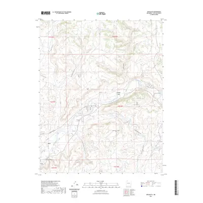
2023 Map of Archuleta
USGS Topo · Published 2023About this map
The San Juan River winds through this corner of San Juan County, defining a landscape of deep canyons and mesas north of the Carson National Forest boundary. This modern survey shows the vital water management and transportation corridors that sustain the region, from the Citizens Ditch irrigation network to the infrastructure surrounding the Navajo Dam settlement. Genealogists can identify key burial sites such as Archuleta Cem and Our Lady of Guadalupe Cem, which serve the small communities of Archuleta, Blanco, and Turley. The terrain is characterized by dramatic features like Melquidis Point and the Gobernador Canyon Arch, illustrating the erosive power of the drainage systems. Numerous service roads, including Navajo Dam Rd and Girito Rd, provide access to remote ranching and energy-producing areas across Pump Mesa and Martinez Mesa.
Find a feature on this map
41 named features on this map. Tap any name to fly to it.
Don’t see what you’re looking for? This feature index may not catch every label — zoom into the map to look around manually.
Map Details
Editions of this 2023 Archuleta Map
This is the sole edition of this map. No revisions or reprints were ever made.
Other maps of this area

1889 · Largo
USGS Topo · 1:250,000

1895 · Largo
USGS Topo · 1:250,000

1954 · Pine River
USGS Topo · 1:24,000
1954 · Burnt Mesa
USGS Topo · 1:24,000

1954 · Aztec
USGS Topo · 1:250,000

1958 · Aztec
USGS Topo · 1:250,000

1959 · Gould Pass
USGS Topo · 1:62,500

1959 · Aztec
USGS Topo · 1:62,500

1959 · Navajo Dam
USGS Topo · 1:62,500

1960 · Bloomfield
USGS Topo · 1:62,500