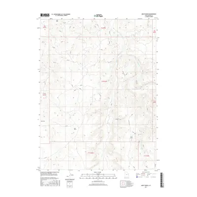
2017 Map of Archy Bench
USGS Topo · Published 2017About this map
Archy Bench and East Bench define the high ground of this Uintah County landscape, where the White River and Bitter Cr have carved deep drainages through the terrain. The map documents a sparsely populated region primarily defined by its physical geography and the infrastructure of the local road network. Transport is facilitated by routes such as Archy Bench Rd and the Bitter Creek Cutoff, which provide access through the complex topography of the basin. The presence of Sand Wash in the northwest further illustrates the arid character of this area. This survey by the U.S. Geological Survey preserves the exact township and range grid, including t10s r22e, providing a precise record of land divisions in this part of eastern Utah.
Find a feature on this map
17 named features on this map. Tap any name to fly to it.
Don’t see what you’re looking for? This feature index may not catch every label — zoom into the map to look around manually.
Map Details
Editions of this 2017 Archy Bench Map
This is the sole edition of this map. No revisions or reprints were ever made.
Other maps of this area

1885 · East Tavaputs
USGS Topo · 1:250,000

1885 · Ashley
USGS Topo · 1:250,000

1907 · Jensen
USGS Topo · 1:125,000

1910 · Jensen
USGS Topo · 1:125,000

1917 · Vernal
USGS Topo · 1:125,000

1954 · Vernal
USGS Topo · 1:250,000

1956 · Grand Junction
USGS Topo · 1:250,000

1958 · Vernal
USGS Topo · 1:250,000

1959 · Grand Junction
USGS Topo · 1:250,000

1960 · Vernal
USGS Topo · 1:250,000