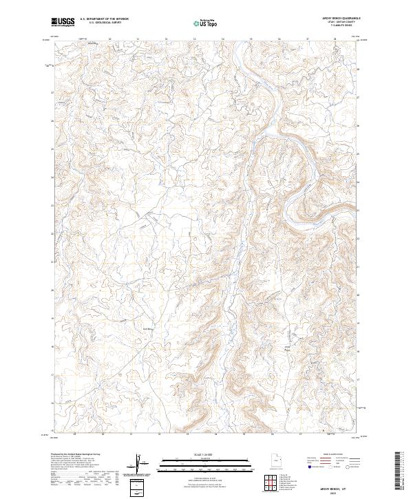
2023 Map of Archy Bench
USGS Topo · Published 2023About this map
White River carves a winding path through this corner of Uintah County, creating a deeply eroded landscape defined by high plateaus and alluvial valleys. The topography is dominated by the broad, flat expanses of Archy Bench and East Bench, which rise above the surrounding drainage networks. To the north, the terrain transitions into Sand Wash and the distinctive formations of the Seven Sisters along the river's edge. Access to this remote region is limited to a sparse network of unpaved routes, including Glen Bench Rd and the Bitter Creek Cutoff, which facilitate movement between the benches and the water. This 2023 survey by the U.S. Geological Survey details the intricate drainage of Bitter Creek as it feeds into the main river channel, illustrating the stark natural boundaries that dictate travel and land use in this part of the Uinta Basin.
Find a feature on this map
10 named features on this map. Tap any name to fly to it.
Don’t see what you’re looking for? This feature index may not catch every label — zoom into the map to look around manually.
Map Details
Editions of this 2023 Archy Bench Map
This is the sole edition of this map. No revisions or reprints were ever made.
Other maps of this area

1885 · East Tavaputs
USGS Topo · 1:250,000

1885 · Ashley
USGS Topo · 1:250,000

1907 · Jensen
USGS Topo · 1:125,000

1910 · Jensen
USGS Topo · 1:125,000

1917 · Vernal
USGS Topo · 1:125,000

1954 · Vernal
USGS Topo · 1:250,000

1956 · Grand Junction
USGS Topo · 1:250,000

1958 · Vernal
USGS Topo · 1:250,000

1959 · Grand Junction
USGS Topo · 1:250,000

1960 · Vernal
USGS Topo · 1:250,000