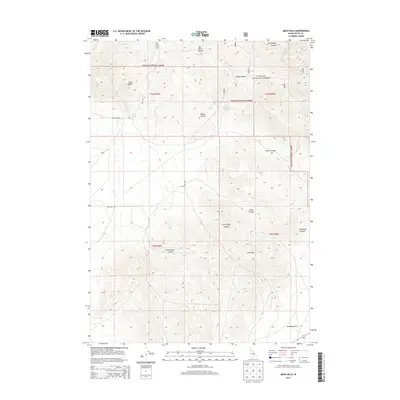
2013 Map of Arco Hills
USGS Topo · Published 2013About this map
The Lost River Range and Arco Hills define this high-altitude landscape of Butte County, Idaho. Much of the northern terrain is managed as part of the Challis National Forest, where steep drainages like Brier Canyon and Wood Canyon carve through the mountain slopes. This 2013 survey illustrates a dry, demanding environment where water is a vital resource, evidenced by scattered features like King Spring, Walker Spring, and the Combe Reservoir.
Find a feature on this map
22 named features on this map. Tap any name to fly to it.
Don’t see what you’re looking for? This feature index may not catch every label — zoom into the map to look around manually.
Map Details
Editions of this 2013 Arco Hills Map
This is the sole edition of this map. No revisions or reprints were ever made.
Other maps of this area

1955 · Idaho Falls
USGS Topo · 1:250,000

1958 · Idaho Falls
USGS Topo · 1:250,000

1969 · Arco Pass
USGS Topo · 1:24,000

1969 · Ramshorn Canyon
USGS Topo · 1:24,000

1969 · Howe
USGS Topo · 1:24,000

1972 · Arco North
USGS Topo · 1:24,000

1972 · Arco Hills SE
USGS Topo · 1:24,000

1972 · Arco South
USGS Topo · 1:24,000

1972 · Howe Peak
USGS Topo · 1:24,000

1972 · Butte City
USGS Topo · 1:24,000