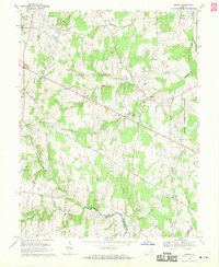
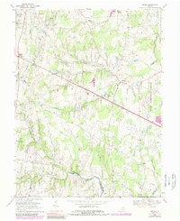
1968 Map of Arcola
USGS Topo · Published 1970About this map
The boundary between Loudoun Co and Prince William Co runs through the southern portion of this landscape, anchored by the winding course of Bull Run. To the east, the edge of Dulles International Airport marks the beginning of the region's modern transformation, while much of the quadrangle remains defined by its earlier agricultural and rural character. Historic crossroads and small communities such as Arcola, Lenah, and Watson are connected by the prominent diagonal of Braddock Road, a thoroughfare that cuts across the terrain from Gilberts Corner toward the southeast.
Find a feature on this map
30 named features on this map. Tap any name to fly to it.
Don’t see what you’re looking for? This feature index may not catch every label — zoom into the map to look around manually.
Map Details
Editions of this 1968 Arcola Map
5 editions found
Other maps of this area

1884 · Harpers Ferry
USGS Topo · 1:125,000

1890 · Mt. Vernon
USGS Topo · 1:125,000

1891 · Harpers Ferry
USGS Topo · 1:125,000

1891 · Mt. Vernon
USGS Topo · 1:125,000

1893 · Frederick
USGS Topo · 1:125,000

1893 · Harpers Ferry
USGS Topo · 1:125,000

1894 · Warrenton
USGS Topo · 1:125,000

1894 · Frederick
USGS Topo · 1:125,000

1894 · Mt. Vernon
USGS Topo · 1:125,000

1897 · Mt. Vernon
USGS Topo · 1:125,000