
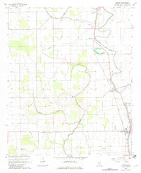
1967 Map of Arcola
USGS Topo · Published 1968About this map
Deer Creek and its winding oxbows like Huddleston Lake dominate this Mississippi Delta landscape, where a dense network of plantation churches and family burial grounds reflects a deeply rooted rural community in the 1960s. The Illinois Central railroad parallels the creek, connecting the town of Arcola with the smaller settlement at Burdette. This survey records a transition in the local landscape, showing numerous water management features like Red Bridge Bayou and Swiftwater Bayou alongside aviation landmarks such as the Frazier Landing Field and a central Lookout Tower. Genealogists will find significant value in the placement of numerous small congregations, including Mt Galilee Ch, New Prosperity Ch, and St Marks Ch, alongside distinct cemeteries like the Old Morning Star Cem and Wilmot Cem.
Find a feature on this map
29 named features on this map. Tap any name to fly to it.
Don’t see what you’re looking for? This feature index may not catch every label — zoom into the map to look around manually.
Map Details
Editions of this 1967 Arcola Map
2 editions found
Other maps of this area

1939 · Readland
USGS Topo · 1:62,500

1939 · Refuge
USGS Topo · 1:62,500

1939 · Tralake
USGS Topo · 1:62,500

1939 · Swan Lake
USGS Topo · 1:62,500

1953 · Greenwood
USGS Topo · 1:250,000

1956 · Greenwood
USGS Topo · 1:250,000
1967 · Tribbett
USGS Topo · 1:24,000

1967 · Leland
USGS Topo · 1:24,000
1967 · Holly Ridge
USGS Topo · 1:24,000
1967 · Swan Lake NW
USGS Topo · 1:24,000