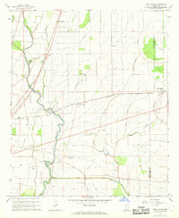
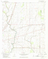
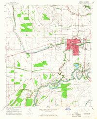
1967 Map of Holly Ridge
USGS Topo · Published 1968About this map
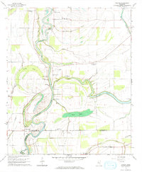
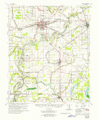
Bogue Phalia defines the drainage of this Mississippi Delta landscape, winding south through an agricultural region dominated by the Illinois Central railroad and a network of secondary bayous. In the late 1960s, small settlements like Rexburg, Dunleith, and Heads anchored a rural society built around cotton farming and river commerce. Evidence of earlier infrastructure is visible in the Old Railroad Grade and the Bogue Phalia Cutoff, which reflect efforts to manage the delta’s complex hydrology. The map provides significant genealogical value through its density of named country churches and family burial grounds, including Old Whitestone Ch, St Matthew Ch, and the Jones Cem. From the landing fields like Morgan Landing Field to the Indian Mound near Hollyknowe, the sheet reveals the layered history of the land from its indigenous roots to the mid-century aviation era.
Find a feature on this map
48 named features on this map. Tap any name to fly to it.
Don’t see what you’re looking for? This feature index may not catch every label — zoom into the map to look around manually.
Map Details
Editions of this 1967 Holly Ridge Map
2 editions found
Other maps of this area

1934 · Cleveland
USGS Topo · 1:62,500

1939 · Tralake
USGS Topo · 1:62,500

1939 · Choctaw
USGS Topo · 1:62,500
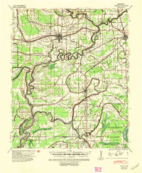
1940 · Baird
USGS Topo · 1:62,500
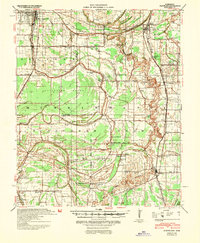
1940 · Cleveland
USGS Topo · 1:62,500

1953 · Greenwood
USGS Topo · 1:250,000

1956 · Greenwood
USGS Topo · 1:250,000
1965 · Indianola
USGS Topo · 1:24,000
1965 · Kinlock
USGS Topo · 1:24,000
1967 · Baird
USGS Topo · 1:62,500