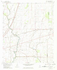
1967 Map of Holly Ridge
USGS Topo · Published 1982About this map
Bogue Phalia dominates this portion of the Mississippi Delta, winding through a landscape shaped by agricultural drainage and early 20th-century transportation. The map reveals a transition in the local infrastructure, showing the Columbus and Greenville road network alongside an Old Railroad Grade and the Illinois Central tracks. Small agrarian settlements and plantation hubs like Dunleith, Hollyknowe, and Holly Ridge are anchors for the community, each supported by a dense network of local landmarks.
Find a feature on this map
47 named features on this map. Tap any name to fly to it.
Don’t see what you’re looking for? This feature index may not catch every label — zoom into the map to look around manually.
Map Details
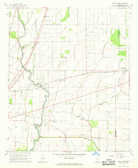
Editions of this 1967 Holly Ridge Map
2 editions found
Other maps of this area

1934 · Cleveland
USGS Topo · 1:62,500

1939 · Tralake
USGS Topo · 1:62,500

1939 · Choctaw
USGS Topo · 1:62,500

1940 · Baird
USGS Topo · 1:62,500

1940 · Cleveland
USGS Topo · 1:62,500

1953 · Greenwood
USGS Topo · 1:250,000

1956 · Greenwood
USGS Topo · 1:250,000

1965 · Indianola
USGS Topo · 1:24,000

1965 · Kinlock
USGS Topo · 1:24,000

1967 · Baird
USGS Topo · 1:62,500