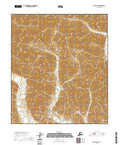
2018 Map of Arctic C-4 SE
USGS Topo · Published 2018About this map
Spring Creek winds through the southwestern corner of this high-latitude terrain within the North Slope Borough. This survey captures a landscape defined by an intricate network of ridgelines and drainages, where Spring Cr serves as the primary hydrological feature. The map provides a detailed view of the Public Land Survey System (PLSS) grid, documenting townships t9s r26e through t11s r27e before modern industrial development or permanent infrastructure altered the drainage patterns. The sheer density of contour lines illustrates the steep, undulating character of the North Slope foothills, offering a precise look at the natural topographical corridors used by wildlife and seasonal water flows.
Find a feature on this map
9 named features on this map. Tap any name to fly to it.
Don’t see what you’re looking for? This feature index may not catch every label — zoom into the map to look around manually.
Map Details
Editions of this 2018 Arctic C-4 SE Map
This is the sole edition of this map. No revisions or reprints were ever made.
Other maps of this area

1951 · Arctic
USGS Topo · 1:250,000

1956 · Arctic
USGS Topo · 1:250,000
1983 · Arctic B-4
USGS Topo · 1:63,360

1983 · Arctic C-3
USGS Topo · 1:63,360

1983 · Arctic B-3
USGS Topo · 1:63,360
1983 · Arctic C-4
USGS Topo · 1:63,360
2018 · Arctic C-4 SW
USGS Topo · 1:25,000
2018 · Arctic C-4 NW
USGS Topo · 1:25,000
2018 · Arctic B-4 NW
USGS Topo · 1:25,000
2018 · Arctic C-4 NE
USGS Topo · 1:25,000