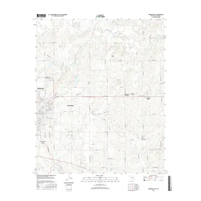
2016 Map of Ardmore East
USGS Topo · Published 2016About this map
The eastern edges of Ardmore transition into a landscape of creek valleys and small water bodies, where modern transportation infrastructure meets long-established rural landmarks. The industrial corridor near Veterans Blvd and the Ardmore Downtown Executive Airport contrasts with the quiet reaches of Caddo Creek and Sand Creek. Genealogists will find several family and community burial grounds, including Cole Cem, Pruitt Cem, and Clearview Cem, which reflect the historic settlement patterns of Carter County. To the east, the communities of Dripping Springs, Dickson, and Provence anchor the local geography. Significant water features like Chickasaw Lake and the northern tip of Lake Murray define the southern terrain, while the area is bisected by the Sam Noble Pkwy, illustrating the region's continued development into the 21st century.
Find a feature on this map
106 named features on this map. Tap any name to fly to it.
Don’t see what you’re looking for? This feature index may not catch every label — zoom into the map to look around manually.
Map Details
Editions of this 2016 Ardmore East Map
This is the sole edition of this map. No revisions or reprints were ever made.
Other maps of this area

1901 · Tishomingo
USGS Topo · 1:125,000

1901 · Ardmore
USGS Topo · 1:125,000

1918 · Ardmore
USGS Topo · 1:125,000

1957 · Ardmore
USGS Topo · 1:250,000

1963 · Ardmore
USGS Topo · 1:250,000

1963 · Mannsville
USGS Topo · 1:24,000

1963 · Mc Millan
USGS Topo · 1:24,000

1963 · Nebo
USGS Topo · 1:24,000

1964 · Lake Murray
USGS Topo · 1:24,000

1964 · Ardmore East
USGS Topo · 1:24,000