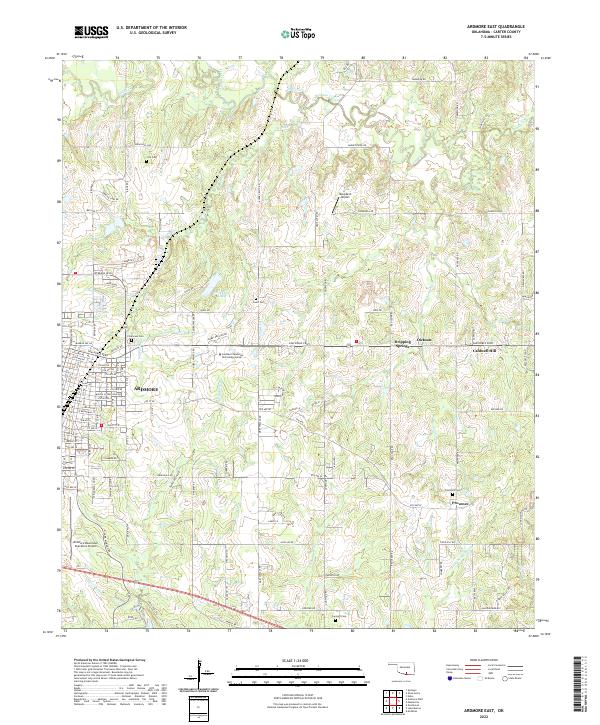
2022 Map of Ardmore East
USGS Topo · Published 2022About this map
The eastern expansion of Ardmore and its neighboring communities in Carter County define this landscape, where urban streets transition into the rolling creek drainages of the southern Oklahoma interior. The area is anchored by Chickasaw Lake and the winding courses of Caddo Creek and W Anadarche Cr. Significant for genealogical research, the map identifies several local burial grounds including Cole Cem, Pruitt Cem, Concord Cem, and Provence Cem. Industrial and civic growth is evident through the presence of the Southern Oklahoma Technology Center and infrastructure like the Ardmore Downtown Executive Airport. Smaller settlements such as Dickson, Dripping Springs, and Provence are connected by a network of rural roads, including Sam Noble Pkwy and Ponderosa Rd, showing the modern distribution of family homesteads and local commerce outside the city core.
Find a feature on this map
112 named features on this map. Tap any name to fly to it.
Don’t see what you’re looking for? This feature index may not catch every label — zoom into the map to look around manually.
Map Details
Editions of this 2022 Ardmore East Map
This is the sole edition of this map. No revisions or reprints were ever made.
Other maps of this area

1901 · Tishomingo
USGS Topo · 1:125,000

1901 · Ardmore
USGS Topo · 1:125,000

1918 · Ardmore
USGS Topo · 1:125,000

1957 · Ardmore
USGS Topo · 1:250,000

1963 · Ardmore
USGS Topo · 1:250,000

1963 · Mannsville
USGS Topo · 1:24,000

1963 · Mc Millan
USGS Topo · 1:24,000

1963 · Nebo
USGS Topo · 1:24,000

1964 · Lake Murray
USGS Topo · 1:24,000

1964 · Ardmore East
USGS Topo · 1:24,000