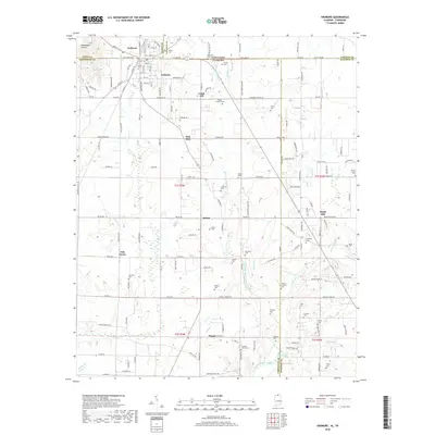
2018 Map of Ardmore
USGS Topo · Published 2018About this map
Ardmore sits squarely on the border of Alabama and Tennessee, acting as a northern gateway for Limestone County. The town is physically bisected by State Line Rd W, while the CSX Transportation railroad line runs north-south through the center of the community. This 2018 survey reveals a landscape where modern development meets deep-rooted local heritage, evidenced by the high density of family cemeteries such as Austin Cem, Gatlin Cem, and Delap-Clement Cem.
Find a feature on this map
101 named features on this map. Tap any name to fly to it.
Don’t see what you’re looking for? This feature index may not catch every label — zoom into the map to look around manually.
Map Details
Editions of this 2018 Ardmore Map
This is the sole edition of this map. No revisions or reprints were ever made.
Other maps of this area

1888 · Huntsville
USGS Topo · 1:125,000

1892 · Huntsville
USGS Topo · 1:125,000

1935 · Athens
USGS Topo · 1:24,000

1936 · Jeff
USGS Topo · 1:24,000

1936 · Capshaw
USGS Topo · 1:24,000

1936 · Taft
USGS Topo · 1:24,000

1936 · Elkmont
USGS Topo · 1:24,000

1936 · Ardmore
USGS Topo · 1:24,000

1936 · Toney
USGS Topo · 1:24,000

1936 · Elkton
USGS Topo · 1:24,000