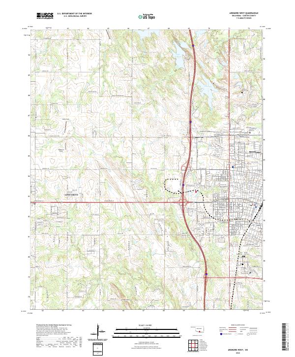
2022 Map of Ardmore West
USGS Topo · Published 2022About this map
Ardmore serves as a major regional hub in this 2022 survey, showing the modern footprint of southern Oklahoma’s development near the Criner Hills. The map details the institutional corridor along the eastern edge, featuring the University Center of Southern Oklahoma and the Carter County Courthouse. To the west, the city of Lone Grove appears as a growing residential center linked by W Broadway St. Genealogists will find a concentration of burial grounds on the southern and eastern outskirts, including Rose Hill Cem, Saint Marys Cem, and Mount Zion Cem. The landscape is a mix of agricultural tracts and industrial airstrips like Colby Field and Taliaferro Field, with local hydrology defined by Hickory Cr and its tributaries as they flow toward Lake Murray.
Find a feature on this map
200 named features on this map. Tap any name to fly to it.
Don’t see what you’re looking for? This feature index may not catch every label — zoom into the map to look around manually.
Map Details
Editions of this 2022 Ardmore West Map
This is the sole edition of this map. No revisions or reprints were ever made.
Other maps of this area

1901 · Ardmore
USGS Topo · 1:125,000

1918 · Ardmore
USGS Topo · 1:125,000

1957 · Ardmore
USGS Topo · 1:250,000

1963 · Ardmore
USGS Topo · 1:250,000

1964 · Lake Murray
USGS Topo · 1:24,000

1964 · Ardmore East
USGS Topo · 1:24,000

1964 · Ardmore West
USGS Topo · 1:24,000
1964 · Gene Autry
USGS Topo · 1:24,000

1964 · Overbrook
USGS Topo · 1:24,000

1964 · Springer
USGS Topo · 1:24,000