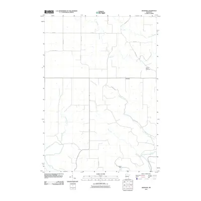
2010 Map of Arendahl
USGS Topo · Published 2010About this map
Arendahl stands at the center of this 2010 survey of Fillmore County, where a complex network of waterways carves through the Minnesota landscape. The southern portion of the quadrangle is defined by the winding course of the Root River, which is joined by several significant tributaries including Raaen Creek and Torkelson Creek. This drainage pattern illustrates the deeply etched topography characteristic of the region, where water moves from upland reaches down toward the river valley.
Find a feature on this map
21 named features on this map. Tap any name to fly to it.
Don’t see what you’re looking for? This feature index may not catch every label — zoom into the map to look around manually.
Map Details
Editions of this 2010 Arendahl Map
This is the sole edition of this map. No revisions or reprints were ever made.
Other maps of this area

1954 · Chatfield
USGS Topo · 1:62,500

1954 · Lewiston
USGS Topo · 1:62,500

1954 · Mason City
USGS Topo · 1:250,000

1957 · Mason City
USGS Topo · 1:250,000

1958 · Mason City
USGS Topo · 1:250,000

1958 · La Crosse
USGS Topo · 1:250,000

1961 · La Crosse
USGS Topo · 1:250,000

1965 · La Crosse
USGS Topo · 1:250,000

1965 · Bratsberg
USGS Topo · 1:24,000
1965 · Lanesboro
USGS Topo · 1:24,000