
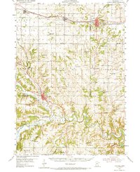
1954 Map of Chatfield
USGS Topo · Published 1956About this map
Chatfield and St Charles serve as the primary hubs in this mid-century portrait of southeastern Minnesota, where the deeply carved valleys of the North Branch Root River and South Fork Whitewater River define the terrain. The landscape is a network of small agricultural townships like Elmira and Saratoga, connected by the Chicago and North Western railroad corridor that runs through Eyota and Dover. Notable for its high density of rural infrastructure, the map shows a vanishing pattern of local education with numerous numbered district schools, including School No 48 and Grand View Sch. From the limestone bluffs of Wadden Valley to the quiet grounds of Root Prairie Ch and Pilot Mound Cem, the map documents a transition in rural life as smaller community centers like Troy and Bucksnort remained while many one-room schoolhouses began to close.
Find a feature on this map
82 named features on this map. Tap any name to fly to it.
Don’t see what you’re looking for? This feature index may not catch every label — zoom into the map to look around manually.
Map Details
Editions of this 1954 Chatfield Map
2 editions found
Other maps of this area

1932 · Cochrane
USGS Topo · 1:62,500

1934 · Plainview
USGS Topo · 1:62,500

1934 · Cochrane
USGS Topo · 1:62,500

1935 · Rochester
USGS Topo · 1:48,000

1937 · Cochrane
USGS Topo · 1:62,500

1938 · Plainview
USGS Topo · 1:62,500

1939 · Rochester
USGS Topo · 1:62,500

1953 · Saint Paul
USGS Topo · 1:250,000

1953 · Eau Claire
USGS Topo · 1:250,000

1954 · Lewiston
USGS Topo · 1:62,500